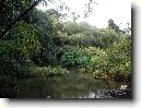
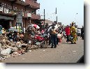
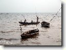
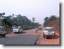
Město: Balogun Itesi, Region: Oyo
Zpět na článek: Nigérie
|
Navigace mapy Celého Světa online: Kliknutím a tažením na mapě Celého světa, nebo použijte zoom kontrol.
Zeměpisná šířka: | 7,1833 (7°10'59.988"N) |
Zeměpisná délka: | 3,5833 (3°34'59.988"E) |
Nadmořská výška: | 146 m |
|
| |
|
|
|
|
GMT čas: +1 hodin | Posun oproti ČR: 0 hodin |
Vzdálenost města Balogun Itesi do 25 největších měst státu: Nigérie
|
Přímá vzdálenost | Km |
| Balogun Itesi - Lagos | 84 km |
| Balogun Itesi - Abia | 510 km |
| Balogun Itesi - Ogun | 4 km |
| Balogun Itesi - Kano | 761 km |
| Balogun Itesi - Ibadan | 41 km |
| Balogun Itesi - Kaduna | 564 km |
| Balogun Itesi - Port Harcourt | 462 km |
| Balogun Itesi - Benin | 245 km |
| Balogun Itesi - Maiduguri | 1 171 km |
| Balogun Itesi - Zaria | 625 km |
| Balogun Itesi - Aba | 477 km |
| Balogun Itesi - Jos | 659 km |
| Balogun Itesi - Ilorin | 181 km |
| Balogun Itesi - Oyo | 84 km |
| Balogun Itesi - Enuga | 439 km |
| Balogun Itesi - Enugu | 439 km |
| Balogun Itesi - Abeokuta | 26 km |
| Balogun Itesi - Sokoto | 677 km |
| Balogun Itesi - Onitsha | 371 km |
| Balogun Itesi - Onicha | 346 km |
| Balogun Itesi - Warri | 303 km |
| Balogun Itesi - Oshogbo | 126 km |
| Balogun Itesi - Okene | 295 km |
| Balogun Itesi - Calabar | 579 km |
| Balogun Itesi - Katsina | 782 km |
Vzdálenost města: Balogun Itesi do Top 10 měst světa
Podpořte nás ·
Kontakt·
Kniha návštěv ·
RoboStav
Copyright (c) 2025 by CELÝSVĚT. Všechna práva vyhrazena!
Kontaktní e-mail: celysvet(zav)email.cz